Google Maps is releasing three APIs that provide information on the environmental status of locations. The APIs use AI and ML to provide the most accurate information.
Google recently introduced the three new APIs. These APIs use AI and ML, combined with satellite and aerial imagery and environmental data, to generate the most accurate information on solar power, air quality and pollen dispersion.
With this information, developers, businesses and organizations can build the right tools that identify and address environmental impacts.
Solar and Air Quality APIs
The Solar API provides insight into the solar reception of rooftops at a given location. The API provides this roof information for more than 320 million buildings in 40 different countries, including the U.S., France and Japan.
For the insights, the model is trained to extract 3D information about roof geometry from satellite or aerial imagery, including details about trees and shading. In addition, the Solar API has historical information about weather patterns in the areas of interest. In this way, it is possible to quickly determine how much sunlight buildings receive. This makes installing solar panels easier, the thinking goes.
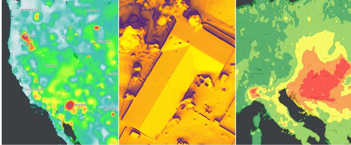
The new Air Quality API provides reliable air quality information, heat maps of air pollution and details about it for more than 100 countries.
The API validates and organizes several TBs of data every hour from different sources. These include government monitoring facilities, meteorological data, sensor and satellite data, and live traffic information. Combining this data should ultimately provide users an accurate picture of local air pollution.
Pollen API
Finally, the Pollen API provides real-time pollen distribution information for hay fever sufferers in 65 countries. Among other things, this API provides data on the number of pollen at a location, heatmaps, detailed plant allergy information and tips for patients to avoid exposure.
Among other things, ML helps determine where specific pollen-producing plants are located for this purpose. This data is combined with wind patterns so that daily pollen abundance and dispersion can be predicted.
The three environmental APIs can now be used in Google Maps.
Tip: Google Workspace updates secure actions in Gmail and help collaborations